Puerto Rico
by National Geographic Maps
✓ In Stock
💰 Cash on Delivery available
Book Details
- ISBN
- 9781566955188
- Publisher
- National Geographic Maps
- Published Year
- 2025
- Pages
- 2
- Language
- English
- Category
- Travel
Description
• Waterproof • Tear-Resistant • Travel Map
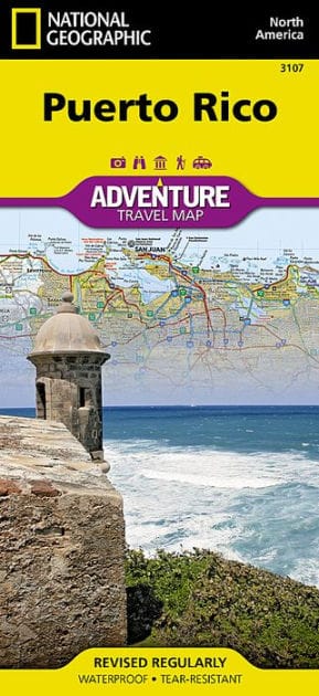
Explore the rich history and many recreation activities available in this lovely island territory with National Geographic's Puerto Rico Adventure Map. Cities and towns are easy to identify and roadway designations are clearly indicated. Monuments and historical locations are noted in addition to a variety of sites for surfing, whale watching, diving, kayaking, wind surfing, sailing, and fishing. The locations of airports, harbors, anchorages, ferry routes, and toll plazas take the guesswork out of travel around the islands. Visitor centers are also marked for travelers seeking additional resources.
One side of the print map includes the western half of the commonwealth including San Antonio, Arecibo, Vega Baja, Mayaguez, Ponce, and more. The reverse side shows the eastern half of the archipelago including San Juan, Fajardo, Caguas, Humacao, Cayey, and Guayama. Inset maps provide greater detail of the San Juan Area, Old San Juan, and Isla Mona.
The Commonwealth of Puerto Rico lies in the northeastern Carribean Sea and attracts both visitors who are looking for a quiet island get-away and adventurers seeking excitement. The islands offer some of the most well-preserved Spanish colonial architecture in the New World, stunning beaches and coral reefs, tropical jungles, and all the modern amenities, hip restaurants, and glitzy nightlife you'd expect from a US territory.
Every Adventure Map is printed on durable synthetic paper, making them waterproof, tear-resistant and tough — capable of withstanding the rigors of international travel.
- Map Scale = 1:125,000
- Sheet Size = 37.75" x 25.5"
- Folded Size = 4.25" x 9.25"