Nevada Easy to Read
by Rand McNally
✓ In Stock
💰 Cash on Delivery available
Book Details
- ISBN
- 9780528029011
- Publisher
- Rand McNally
- Published Year
- 2025
- Pages
- 2
- Language
- English
- Category
- Travel
Description
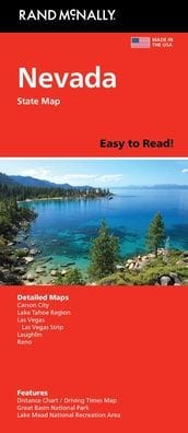
Rand McNally's folded map for Nevada is a must-have for anyone traveling in or through the state, offering unbeatable accuracy and reliability at a great price. Our trusted cartography shows all Interstate, U.S., state, and county highways and much more. - Regularly updated, full-color maps. - Clearly labeled Interstate, U.S., state, and county highways. - Detail maps of major cities, a mileage chart, and a Mileages & Driving Times Map. - Indications of parks, points of interest, airports, county boundaries, and more. - Easy-to-use legend. - Detailed index. - Convenient folded size. Coverage Area Detailed maps include: Carson City, Lake Mead National Recreation Area, Lake Tahoe Region, Las Vegas, Las Vegas Strip, Laughlin, Reno.